Detection and Assessment of Railway Substructure Moisture Problems at Using Remote Sensing Systems
The Mobility Initiative project Early Detection and Assessment of Railway Substructure Moisture Problems at National to Local Scale Using Spaceborne, Airborne and Train-Based Remote Sensing Systems, or short REASSESS, has been concluded in June 2024.

In short
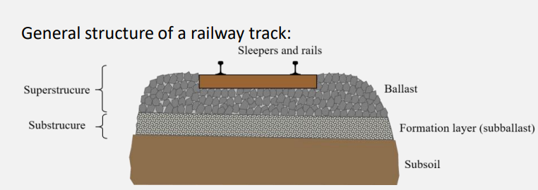
A highly available and affordable railway infrastructure relies on the development of innovative solutions in infrastructure monitoring. The use of remote sensing systems operating from satellites, drones, and mobile mapping platforms offers tremendous potential for preventive and automated monitoring of the railway infrastructure. One of the most common causes for deterioration of the tracks is water intrusion leading to subsurface ballast moisture/wetness. This type of damage results in significant costs for mitigation and repair.
An interdisciplinary team of scientists from ETH Zurich joined forces with SBB to assess different future technologies leading to a more efficient future sensing system. The research team was made up of three different institutes:
- Dr. Othmar Frey (coordinator), Dr. Philipp Bernhard, Manuel Luck the Earth Observation and Remote Sensing group at the Institute of Environmental Engineering,
- Prof. Dr. Andreas Wieser, Dr. Annelies Voordendag, Pia Ruttner-Jansen, Nicholas Meyer from the Geosensors and Engineering Geodesy group at the Institute of Geodesy and Photogrammetry,
- Prof. Dr. Eleni Chatzi, Giacomo Arcieri, Cyprien Hoelzl from the Structural Mechanics and Monitoring chair that is part of the Institute of Structural Engineering,
all from the Department of Civil, Environmental and Geomatic Engineering, ETH Zurich. From the side of the Swiss Federal Railways AG (SBB AG), David Haener, Evelyn Weiss, Oliver Schwery, Nicolas Ackermann, Matthias Niklaus supported and contributed to the project.
Motivation
REASSESS envisions a remote-sensing-based approach to efficiently and timely detect railway track anomalies that serve as a proxy for subsurface ballast moisture. Detection methods based on three remote sensing systems:
- Satellite imaging radar (synthetic aperture radar - SAR),
- (airborne) laser scanning, and
- train-based ground penetrating radar (GPR)
are investigated and assessed using reference data provided by SBB AG.
Satellite imaging radar for proxy-based anomaly detection

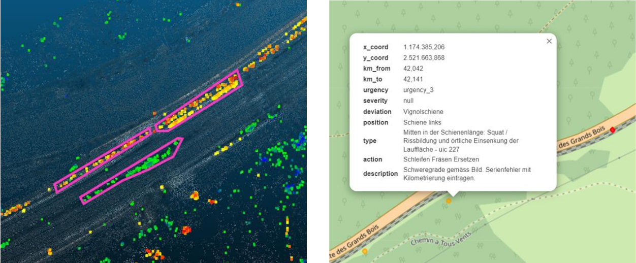
The team investigated a new approach to detect track anomalies based on surface displacements retrieved from interferometric time series of satellite radar data (TerraSAR-X). The performance of the satellite-based detection method is compared to chord-based measurements, which are obtained from survey trains, and which are currently used by SBB as a proxy for track anomalies on a network wide scale. Inspired by the chord-based method’s use of vertical undulations of the track geometry, our proposed approach employs statistics derived from variations of surface displacements along the railway track retrieved with persistent scatterer interferometry (PSI) as proxies for railway track anomalies. This new method could potentially offer a cost-effective mean to monitor railway track infrastructure including all day, all-weather imaging with large spatial coverage at high spatial resolution.

Both, the satellite-based and chord-based methods to detect track anomalies are proxy-based indicators. Both approaches lead to qualitatively similar but not identical detections. A validation remains challenging while the following summary can be concluded:
- We see our satellite-radar-based detection approach as a useful additional source of information that complements chord-based techniques used for an expert-driven identification of anomalies in railway tracks.
- In the future, high-resolution wide-swath (HRWS) imaging radars will provide high spatial resolution and large spatial coverage at the same time, which is needed for a network-wide satellite-based detection.
Scanning for deformation and moisture proxies
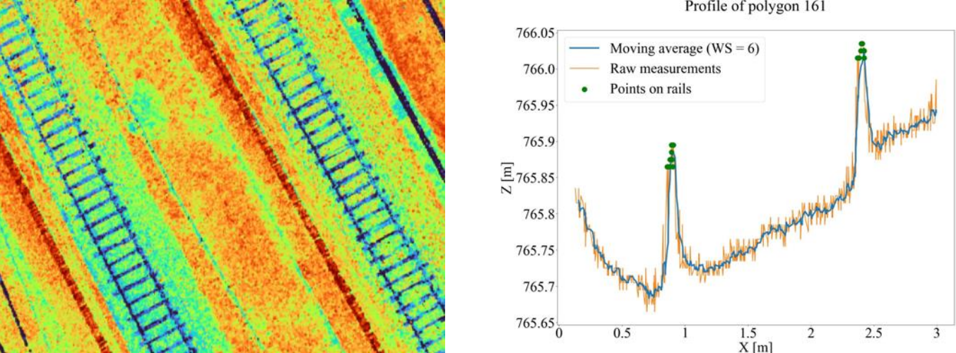
Additionally, the team investigated the detection and quantification of ballast moisture proxies in airborne LiDAR point clouds.
The first focus was on optimally extracting surface deformations. They compared (i) approaches sensitive only to displacements perpendicular to the surface and (ii) machine-learning based approaches exploiting the structure of the ballast to derive 3D displacements.
The other focus was on more direct moisture proxies, like clay fouling or vegetation changes. While we could not find a benefit of the LiDAR data for these proxies, the sensitivity for deformation analysis could be increased substantially through spatial filtering with and without exploiting rails and sleepers within the point clouds.
Using this second methodology (LiDAR point clouds) we learned that non-deformation moisture proxies can be better determined using images instead of point clouds. We concluded the following:
- Estimating moisture from monochromatic LiDAR intensities is only possible under very restrictive conditions.
- Direct estimation of 3D displacements of the ballast from point clouds is challenging because the structure is not unique and salient enough.
- Height changes on the order of a few cm can be resolved by spatially averaging over areas of at least about 1 m2; using only the points on sleepers improves the sensitivity to better than 1 cm.
Ground penetrating radar for ballast assessment
We investigated the use of train-based Ground Penetrating Radar (GPR) as a promising solution for early and accurate detection of moisture accumulation in the ballast. We have conducted both simulated and experimental analyses, with the latter carried out on a controlled railway track section, established in collaboration with SBB AG. Our findings demonstrate that GPR systems can effectively detect moisture infiltration in railway tracks, albeit certain challenges still need to be addressed for ensuring accurate and automated assessment. Towards such automation, we will be coupling the GPR derived condition indicators with a reinforcement learning based decision support tool for optimizing maintenance policies.
The experimental results demonstrate the potential of adoption of GPR technology for moisture assessment in the track substructure. Assessing the water content of the track substructure from a single GPR measurement is a challenging task. The main findings were the following:
- The intention is to capitalise on more observations over time, enabling robust detection and dense spatial tracking of moisture content.
- Early detection of moisture accumulation in the substructure can form a potent tool for supporting preventive maintenance actions.
The three techniques have the potential to outperform the state of the art in terms of efficiency, cost reduction and early detection. However, further development, improved raw data and detecting algorithms are required to really make them a robust tool suitable for real applications.
Feedback
A particular challenge we had to overcome was the operational and cost constraints associated to conducting a controlled field experiment on a real railway track section. This turned out to be too demanding and was replaced by the construction of a track model on the ETH campus. The track model allowed conducting close-range sensing and in-situ measurements in a controlled environment and could also be used beyond the scope of the REASSESS project.
“Teaming up with other research groups at ETH and having SBB as a project partner on this interdisciplinary research project was very fruitful. This interdisciplinary approach was crucial to address the different and interrelated aspects of a future remote-sensing based railway track monitoring system.”ETH Team
We experienced in this project how important is to timely communicate, manage, and consolidate expectations on both sides, research and operational scenario, to successfully complete the project. In general, the team was satisfied with the Mobility Initiative framework which brought the different research groups and industry partners together.
From the side of SBB, David Häner acknowledged the collaboration with ETH which enabled the team to gain insight into the latest methods and possibilities in the field of data science and geospatial monitoring systems. Reflecting on the challenges encountered, David points to finding a clear formulation to rather complex problem on the part of SBB AG. Another challenge was the collection and compilation of railway-specific expert knowledge, some of which was not explicitly documented but only available in the employees’ minds (SBB AG). That initial part, however, was critical in order to ensure that SBB and ETH project members could efficiently communicate and interact thought the project execution and to guarantee that the scientists could work efficiently on this research project.

“The collaboration with ETH researchers was very enriching and we definitely expanded our professional network.”David Häner (Product Owner for Track Data Laboratory, Track Specialist, SBB AG)
Looking back, David Häner recognizes that at the beginning, the SBB team underestimated the personnel effort involved in this project. Nevertheless, he would take part in such a project again at any time.
“The REASSESS project has shown that remote sensing systems have great potential for the early detection and assessment of moisture problems and track anomalies. To utilize the advantages of these systems / methods, they must be gradually integrated into current, productive monitoring processes. The next major step is to tackle further research and automation of ground penetrating radar technology (GPR) within an Innosuisse project (together with ETH). Furthermore, we will remain in regular contact with ETH researchers and possibly launch other remote sensing-based follow-up research projects.”
Project team and research groups
SAR Remote Sensing Technology
- Dr. Othmar Frey (Project Coordinator)
- Dr. Philipp Bernhard
- Manuel Luck
Geosensors and Engineering Geodesy
- Prof. Dr. Andreas Wieser
- Dr. Annelies Voordendag
- Pia Ruttner-Jansen
- Nicholas Meyer
Structural Mechanics and Monitoring
- Prof. Dr. Eleni Chatzi
- Giacomo Arcieri
- Cyprien Hoelzl
Swiss Federal Railways AG (SBB AG)
- David Haener
- Evelyn Weiss
- Oliver Schwery
- Nicolas Ackermann
- Matthias Niklaus


